Hiking and Cycling to Punta Larici: directions and tips
Punta Larici offers the most spectacular views over Upper Garda, and it’s often mentioned as one of the most popular excursions on foot or by mountain bike in the Ledro Valley. There are many reasons why this place is so famous and well liked: because the view that can be enjoyed from Punta Larici is simply spectacular and priceless; because the excursion is quite easy, requiring medium physical effort; because from Pregasina it is possible to get to the top in just over an hour; and because it is possible to add Punta Larici to longer and more complex itineraries. To sum up, there are plenty of reasons to pack your backpack - and maybe even your bike - and set off towards this natural balcony on Lake Garda! This peak reaches 907 meters above sea level, and it is located right between the enchanting Ledro Valley and the expanse of Lake Garda, in the ideal location to take unforgettable panoramic photos.
The itinerary to Punta Larici from Pregasina, on foot and by mountain bike
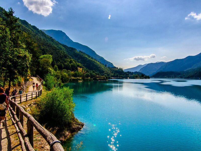
The quickest way to get to Punta Larici is from Pregasina, the town located at the beginning of the Ledro Valley. We are talking about a village overlooking Lake Garda, at 532 meters above sea level, well known by those who love outdoor activities in the Upper Garda area. Whether you prefer to hike or ride your mountain bike, the directions to follow are the same. The itinerary starts from the center of town, from the church of San Giorgio, where you can also find places to park your car. From there, take path 422B, leading all the way to our destination, Punta Larici. Taking a wrong turn is practically impossible! Although not difficult, this route should still be covered with suitable footwear, paying attention to the cliffs and gusts of wind. Leaving the center of Pregasina, you’ll cross the woods, gaining altitude, and reach Bocca Larici, where it is already possible to enjoy a first view of the lake below; However, you need to carry on a little further to reach the top, following a steep path. To get back, follow the same itinerary in reverse. In total, the round trip is almost 6.5 kilometers, with 450 meters of positive elevation.
The panorama from Punta Larici
Reachable year round, given its low altitude, Punta Larici offers dream views in every season and at every hour. In summer, many set out from Pregasina at the first light of dawn, while others plan to reach the summit at the beginning of dusk, and then head back towards the Ledro Valley before darkness (provided you know the path well and always have a front safety light with you!)
From this rock spur overlooking the lake, you’ll get one of the most scenic views in the whole of Trentino. Your gaze will travel over the expanse of the lake, to the many villages along the shore, all the way up to the unmistakable Sirmione peninsula. You can also notice several peaks, from the lower Monte Brione, between Riva del Garda and Torbole, up to Monte Stivo, Monte Altissimo and the majestic Monte Baldo.
For those who want a longer adventure: other itineraries with Punta Larici
Whether you travel on foot or by bike, the excursion from Pregasina to Punta Larici is quite short. However, it is possible to make it longer by starting from Riva del Garda, tackling the famous Strada del Ponale, to significantly increase altitude difference.
Well-trained and steady-footed hikers can also include Punta Larici in the more complex tour of the Pregasina ridges, including other lesser-known but very panoramic peaks, like the Bal and Nara peaks. In this case, the total distance from Pregasina is 12 km, with a 1000-meter altitude difference.